

12. Torrington’s Revival: the 18th and 19th centuries
When the monarchy was reinstated in 1660, known as the ‘Restoration’, Charles II gave grants to towns which had remained loyal to the crown and which had been damaged in the Civil War. Torrington received such a grant. Much of the market square and Guildhall were repaired and the town flourished into the 18th century.
Torrington has two exceptional 18th century townhouses; Cawsey House and Palmer House. Cawsey House in South Street is near the car park, where the trail starts and finishes (you can’t miss it look for the fine ‘shell’ door with plaster decoration!). It is Grade II* Listed and preserved by the Landmark Trust and can be rented out as a holiday let. It was built by Giles Cawsey, the Town Clerk for the Borough Council and a wealthy merchant in 1701 and may have been designed by famous architect Nathaniel Gascoyne. Cawsey House is lucky to have survived the devastating fire of 1724 and begs the question; what other fine houses may have been lost to the flames?
Palmer House, on New Street is just opposite the churchyard (look to the north, across the road), with a fine decorated Palladian brick facade. It is also Grade II* Listed, but is still a private house. It was built a little later by Sir John Palmer in 1752. John was an influential solicitor and three-times Mayor of Great Torrington. John’s wife was born Mary Reynolds, the older sister of painter Sir Joshua Reynolds, who founded the Royal Academy of Arts and was its first president. Mary was also talented, an author who documented and recorded the historic Devonshire dialect and wrote, ‘A dialogue in the Devonshire Dialect’, which was published with additions by her grandson in 1837. The reading room from the gardens at Palmer House can now be visited down at Rosemoor.
Torrington also has three fine suburban 18th /19th century garden villas off South Street and Castle Street; Caynton House and Castle Hill House, with Castle House. Caynton House, built by another lawyer, which stands behind Mill Street, once within its own pocket landscaped ‘park’, in fact large walled gardens. The house is Listed Grade II, of Georgian style. William Young Esq., from Caynton, Shropshire is buried in the churchyard at Great Torrington, having been a solicitor in the town, dying in 1768 (Lysons, 1822) and the house is attributed to him, believed to have been built in the 1740s. This house can be seen from the South Street car park, which was once part of its gardens (the large white house to the west) and from the commons, Old Maids Walk, it is still a private house.
Castle Hill House and its gardens and wall was built on the expanded former castle site, in a series of walled enclosures, remodelled as gardens behind South Street. It is a Regency villa, Grade II Listed but is now the Visitor Information Centre, Library, the community Cafe is located in the garden and the house also contains the council offices; you can enter the lobby however, form the car park and see the wonderful spiral staircase in the central hallway. It is believed the house which echoes the medievalist style of Town Mills and appears cohesive with the parkland remodel of the commons on the south side of the town, may have been built for one of Lord Rolle’s estate officials in charge of the Torrington aspects of the Rolle estates.
Castle House, believed to have been built by a former Mayor of Torrington. Grade II Listed and stands within surviving walled gardens (now a privately run care home/nursing home). Regency style, also built within the former grounds and walled enclosures of the former castle site. You can walk up past the house to the castle along Castle Street.
All four of the above buildings represent the top of Torrington society, the political and legal establishment but Torrington also retains a valuable group of buildings at the top of Mill Street, where it adjoins important South Street; these are a group of merchant’s town houses, of more middle status these form a cohesive and contemporary setting for an early Wesleyan chapel and allow us to appreciate how gracious Torrington would have been in the Georgian period; the region economically buoyant on sheep farming, the growth of the dairy industry and trade to the ports of Bideford and Barnstaple. All of the buildings can be passed on the trail, as you walk up and around Whites Lane, to South Street, returning to the South Street car park (the start and finish of the walk). All are either Grade II Listed or Listed as a group and form a crucial part of the character of the Historic Conservation Area.
There is a second valuable group of Georgian and Regency merchant’s houses on Castle Street which was rebuilt significantly after damage from the civil war and then the 1724 fire. There is also a grand Regency townhouse on the corner of Calf Street and Potacre Street facing down the new toll road.
There was a devastating fire in Torrington in 1724; many houses were damaged and others were wholly lost in and around the square and along Cornmarket Street, South Street and Castle Street. This was a huge set-back for a town so badly damaged in 1646 and only rebuilt between 1660-1700. Not only were buildings damaged and people injured but the medieval Guildhall, which had withstood the battle was consumed by the flames with the loss of all of the historic town and manor records, already as much as almost 1000 years of history lost.
Friends of Sir Joshua Reynolds often accompanied him on his holidays to Devon to visit his sister; a regular visitor was Dr. Samuel Johnson (1709-1784) who famously published the world’s first dictionary in 1755. Dr Johnson was infamously greedy and horrified the Palmer family when he once stayed, by eating a whole stack of pancakes, bread, yoghurt and fruit which had been laid out for breakfast for the whole family.
The rebuilt guildhall which stood alone in the market square was one of the buildings lost in a devastating fire in 1724, which affected the market square, with the loss of all of the town’s historic records. The guildhall was rebuilt as a more modern Town Hall with Assembly rooms in the modern style on the first floor; then extended in grand style in the 1860s.
Thomas Fowler was born in Great Torrington in 1777 and was the son of a cooper, a merchant who made and sold barrels. Whilst young Thomas was apprenticed to a trade, he taught himself mathematics and soon became manager of the local bank (Messrs. Loveband & Co. you can still see the very fine Regency facade of Bank House in the square, No.5!) Thomas was passionate about social justice and was treasurer for the Poor Law Union. In 1828 Thomas patented an early central heating system. Then in the 1830s he developed a series of currency tables to help calculate parish fees for poor relief and in 1840 he invented a calculating machine, an early form of computer, which went on to be exhibited in London at Kings College Museum. A replica of his machine is now exhibited in the Science Museum.
There was a Workhouse in Torrington until 1834, located south of New Street, to the west end of the town it was built for 200 inmates. Designed by Sampson Kempthorne, it had wings creating four enclosed courtyards. Formally recorded in a parliamentary report in 1777; there were 20 inmates and the report recorded terrible conditions.
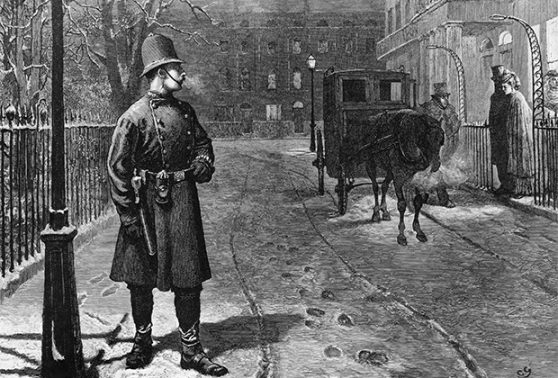
Before 1839, there was no formal police force, but Torrington had a Parish Constable from medieval times, who undertook crowd-control and maintained order. The Constable was paid by the Town and had a staff and a baton. There was obviously rather a scandalous issue of Constables in Torrington being drunk on the job! A meeting in the Guildhall in the early 18th century announced ‘no ale should be allowed to the constable unless when at a bonfire which the Mayor and Corporation shall be present.’
The Torrington House of Correction or Gaol was located near the Workhouse along or below Warren Lane. It was derelict by 1836 and in 1839 a new police house and buildings were built to the west side of the churchyard (in front of you now, named Peel House!) after the government passed the County Police Act, which required local forces to be created and maintained.


School resources
Georgian Britain – Age of Modernity
https://www.nationalarchives.gov.uk/education/resources/georgian-britain-age-modernity
The Slave trade and 18th century
http://www.nationalarchives.gov.uk/education/teachers/professional-development/project-resources/transatlantic-teachers-resources-2011/african-slave-trade
British Library- The Literature – Restoration and 18th century
https://www.bl.uk/restoration-18th-century-literature/teaching-resources
British Library – The Literature – Victorians and Romantics
https://www.bl.uk/romantics-and-victorians/teaching-resources
BBC Bitesize – Charles Dickens and the Workhouse
https://www.bbc.co.uk/programmes/b01f9xyl/clips
BBC History – KS2 – The Victorians
https://www.bbc.co.uk/bitesize/topics/zcjxhyc
Schools History – Industrial Revolution – KS3 Resources
https://schoolhistory.co.uk/industrial/industrial-revolution
Thomas Fowler – Inventor – Biographer
https://history-computer.com/thomas-fowler-biography-history-and-inventions
Victorian Prisons – teaching resources
https://www.nationalarchives.gov.uk/education/resources/victorian-prison/
Further reading
Royal Society – Thomas Fowlers – Description of a calculating machine
https://royalsocietypublishing.org/doi/10.1098/rspl.1837.0130
Bio of Mary Reynolds Palmer
https://en.wikisource.org/wiki/Dictionary_of_National_Biography,_1885-1900/Palmer,_Mary
Great Torrington Borough Gaol
https://www.prisonhistory.org/prison/great-torrington-old-borough-gaol-or-bridewell/
National Gallery – Sir Joshua Reynolds
https://www.nationalgallery.org.uk/artists/sir-joshua-reynolds
Royal Academy – Sir Joshua Reynolds
https://www.royalacademy.org.uk/art-artists/name/joshua-reynolds-pra
Dr Johnsons House – biography
https://www.drjohnsonshouse.org/johnson.html
History of London – Dr Johnson – bio
https://www.thehistoryoflondon.co.uk/dr-samuel-johnson/
Architecture in 18th century England
http://umich.edu/~ece/student_projects/exoticism/English.htm
English Heritage – Georgian Architecture
https://www.english-heritage.org.uk/learn/story-of-england/georgians/architecture
19th century Architecture
http://www.visual-arts-cork.com/history-of-art/nineteenth-century-architecture.htm#:~:text=The%20main%20types%20of%20nineteenth,1850%2D1900)%3B%20Skyscraper%20design%20(
Economic History Association – Child Labour in the Indistrial revolution
https://eh.net/encyclopedia/child-labor-during-the-british-industrial-revolution
History of the Police
https://british-police-history.uk/cgi-bin/index.cgi
National Heritage Records for Listed Buildings
No.28 South Street
Cawsey House
UID List No: 1104743
Grade II *
List date: 1973
List Text: Dated 1701, 2 storey, 5 window red brick front. String course. Heavy eaves cornice with brackets. Roof has 3 pedimented dormers, the central one segmental. Original lead down-pipe has enriched rain-water head with initials “CGM” and date. Sash windows. Doorway has shell hood on modillion brackets. Fine plaster work to under-side of hood consists of central cartouche with grouped weapons surrounding it. This house is almost identical with No 28 Bridgeland Street, Bideford, which Professor Richardson attributed to Nathaniel Gascoyne (1695). The Bideford example has lost its original doorway. Interior: one panelled front room to ground floor has exceedingly fine ceiling. This has round centre panel with a group of musical instruments in high relief. (cf Denham Place, Bucks, circa 1693). Foliage ornament in quadrant panels. Otherwise the interior is cut about and altered. All the listed buildings in South Street form a group.
Link to National Record: https://historicengland.org.uk/listing/the-list/list-entry/1104743
Palmer House
UID List No: 1104777
Grade II*
List date: 1951
List Text: Dated 1752. Built by Mr (later Sir) John Palmer, brother-in-law of Sir Joshua Reynolds. The latter stayed here many times. Dr Johnson is also said to have been a visitor. Front is red brick, 3 storey, 5 windows, divided into three by brick Ionic pilasters with stone bases and caps. Entablature with pulvinate frieze is interrupted between pilasters. Main eaves cornice is continuous, breaking forward above pilasters. Low-pitched slate roof. Sash windows with glazing bars, and rubbed brick flat arches with keystones (ground floor later sashes). Doorway has moulded architrave and pediment on scroll consoles. 6-panel door with fielded upper panels. Frontage is set back behind later cast iron railings. Tall brick return walls have piers with vases, parapets swept up to meet front wall of house. At the back a wing was added late C18. This is slate hung supported on piers and arches forming a Ioggia. Large 3-light bow window. There is a walled garden, the wall having piers and vases. Octagonal gazebo at north east corner has been re-erected at Rosemoor Gardens, Great Torrington. Interior: front ground floor room (1752) has enriched plaster ceiling with Palmer arms and Ionic mantel. Attractively planned staircase with slender turned balusters. Half-landing has Venetian window with Palmer arms in stained glass.
Link to National Record: https://historicengland.org.uk/listing/the-list/list-entry/1104777
6 and 8 New Street (incorporate outbuilding to Palmer House)
UID List No: 1161777
Grade II
List date: 1973
List text: These have 2 storey stucco modern fronts to the street but they incorporate outbuildings which once belonged to Palmer House. There are one or two C18 details where the buildings face on to the old stables. No 6 has a modern shop window throughout the frontage. Nos 6 to 10 (even) and Palmer House form a group.
Link to National Record: https://historicengland.org.uk/listing/the-list/list-entry/1161777
Porch House, 83 New Street
UID List No: 1333001
Grade II
List date: 1951
List text: Circa 1700 with alterations. 2 storey. Seven 1st floor flush frame sash windows with glazing bars. Dark red brick front. Cove cornice. String course at 1st floor includes 2 courses of diagonally set headers. One ground floor window left, is a splayed bay with altered glazing &c. Later brick porch apparently adapted from a Tuscan porch. Later slates to roof. Brick chimneys with moulded caps.
Link to National Record: https://historicengland.org.uk/listing/the-list/list-entry/1333001
Caynton House
UID List No: 1104770
Grade II
List date: 1973
List Text: Late C18 or early C19, 2 storey stucco house standing in garden, its south front overlooking valley. Hipped slate roof. Dentil cornice. North front has Tuscan doorcase and one sash window. South front is 4 window.
Link to National Record: https://historicengland.org.uk/listing/the-list/list-entry/1104770
Castle Hill House
UID List No: 1104744
List date: 1951
Grade II
List Text: Circa 1820 large house standing back in garden, but approached from South Street.
Hipped slate roof. 2 storey 4 sash windows, with glazing bars, to garden front. Cornice. Parapet. Stone wall at south end of garden abuts on public walk overlooking valley and is in the same style as the Town Mills and probably mid C19. A projecting tower in the centre has pointed door opening and sunk rectangular and circular panels above. Walls on each side of this have sunk cruciform panels. Castellated parapets. Behind the wall is a vaulted outhouse and a flight of steps to garden level. The design of the walls was probably inspired by the proximity of the Castle site. It is an attractive feature giving interest to the public walk and to views of the town from this side. All the listed buildings in South Street form a group.
Link to National Record: https://historicengland.org.uk/listing/the-list/list-entry/1104744
Castle House
UID List No: 1310018
List date: 1951
Grade II
List Text: Late C18 or early C19, with garden front added circa 1820. Now a Nursing Home. Said to have been built of stone from Castle ruins. Square, 2 storey, stucco. Sash windows. Ogee bracket cornice. Garden front lower storey projects with 4 tall sash windows with glazing bars. Centre recessed Greek Doric porch with fluted columns and pilasters in antis, guttae to entablature. Above this is a deep balcony with good iron balustrade and canopy supported on slender cast iron columns.
Link to National Record: https://historicengland.org.uk/listing/the-list/list-entry/1310018
Corner House, 18 Potacre Street
UID List No: 1332964
Grade II
List date: 1973
List Text: Early C19, stucco house on corner of Calf Street. 3 storey 3 window front. Quoin pilasters. Moulded eaves cornice. Sash windows with glazing bars, rusticated voussoirs and keys. Doorcase has engaged Tuscan columns supporting entablature. Patterned radial-bar fanlight. High garden wall to Calf street has parapet swept up to gate piers with terra-cotta ball finials, wrought iron overthrow with Victorian lamb. Bow window at back of house.
Link to National Record: https://historicengland.org.uk/listing/the-list/list-entry/1332964
The exceptional group of merchants houses on South Street:
Furze House, 42 South Street; Grade II
National Record: https://historicengland.org.uk/listing/the-list/list-entry/1104747
31 & 33 South Street; Grade II (grouped pair)
National Record: https://historicengland.org.uk/listing/the-list/list-entry/1104740
44 South Street; Grade II
National Record: https://historicengland.org.uk/listing/the-list/list-entry/1104748
Hillingdon House, 46 South Street; Grade II
National Record: https://historicengland.org.uk/listing/the-list/list-entry/1104749
1 Mill Street; Grade II
National Record: https://historicengland.org.uk/listing/the-list/list-entry/1104768
3 Mill Street; Grade II
National Record: https://historicengland.org.uk/listing/the-list/list-entry/1104769
5 Mill Street; Grade II
National Record: https://historicengland.org.uk/listing/the-list/list-entry/1161727
The group of 18th/19th century merchants houses on rebuilt/remodelled Castle Street (after the 1724 fire):
9-13 Castle Street; Grade II
National Record: https://historicengland.org.uk/listing/the-list/list-entry/1161644
18 & 20 Castle Street; Grade II
National Record: https://historicengland.org.uk/listing/the-list/list-entry/1104792
21-25 Castle Street; Grade II
National Record: https://historicengland.org.uk/listing/the-list/list-entry/1104794
24 Castle Street; Grade II
National Record: https://historicengland.org.uk/listing/the-list/list-entry/1247095
Green Lantern Restaurant and Bakery
UID List No: 1104764
Grade II
List date: 1973
List Text: C18 3 storey 3 window front, red brick.
Sash windows with flush frames, glazing bars and keystones. 2nd floor windows are only 2 panes high. Projecting shop front has one bay with glazing bars.
Link to National Record: https://historicengland.org.uk/listing/the-list/list-entry/1104764
5 High Street
UID List No: 1104761
List date: 1973
List text: Circa 1830. Bank opened 1834, 2 storey, 4 windows, stucco front, painted, lower storey rusticated. Moulded cornice below parapet and at 1st floor level. Round-headed doorway, right. 1st floor sash windows with centre glazing bars and alternating pediments on consoles.
Link to National Record: https://historicengland.org.uk/listing/the-list/list-entry/1104761
10 High Street
UID List No: 1104765
List date: 1973
List Text: Probably C18 altered, 3 storey roughcast front, upper floor timber-framed with waterproof refacing. Former sash windows replaced by modern wood casements. Eaves fascia, with wood dentils, remains. Continuous C19 projecting shop front with central entrance.
Link to National Record: https://historicengland.org.uk/listing/the-list/list-entry/1104765
13 High Street
UID List No: 1332996
List date: 1973
List Text: Probably C18 with alterations. 3 storey 3 window rendered front. Early C19 moulded eaves fascia. Mid C19 shop front with cast iron mullions sash windows above with glazing bars. Left hand is entry with good panelled doors.
Link to National Record: https://historicengland.org.uk/listing/the-list/list-entry/1332996
Gazebo at Rosemoor Gardens
UID List No: 1271247
List date: 2000
List Text: Gazebo. Circa mid C18, possibly 1752, the date of Palmer House where it was formerly situated; re-erected 1999. Rendered stone rubble, slate-hung first floor. Hipped slate roof with lead rolls to hips, and small ball finial and wrought-iron weather-vane at apex. Stack at side with short brick shaft. PLAN: Octagonal on plan with flight of steps at rear to heated first floor room. EXTERIOR: 2 storeys. Front has canted window on first floor with three 12-pane sashes with thick glazing bars and small window on ground floor. At rear, stone stairs with restored iron balustrade to first floor doorway with panelled door and restored wooden porch; renewed 12-pane sashes on first floor to left and right of doorway. INTERIOR: Small stone fireplace with slate hearth and flanking china cupboards with panelled doors; panelling below bay window and moulded dado rail. NOTE: This gazebo was formerly situated at Palmer House, New Street, Great Torrington, and was re-erected on its present site at Rosemoor Gardens in 1999. Palmer House was built for [Sir] John Palmer, brother-in-law of Sir Joshua Reynolds, who visited the house together with Dr Johnson.
Link to National Record: https://historicengland.org.uk/listing/the-list/list-entry/1271247
Town Mills
UID List No: 1104784
Grade II
List date: 1951
List Text: Built by Lord Rolle in mid C19 and probably designed to complete a romantic riverside group seen from the town above. The front of the group of buildings used as a farmhouse is of stone with corner towers and castellated parapets, chimney in form of octagonal turret. Wood casements with hood moulds. Projecting porch. Decorative panels either with pointed heads or of cruciform shape.
Link to National Record: https://historicengland.org.uk/listing/the-list/list-entry/1104784
New Bridge
(Town Mills Bridge)
UID List No: 1105023
Grade II
List date: 1951
List Text: Road bridge over River Torridge. 1843-6 built by Lord Rolle. Coursed rubble stone construction. Three massive roundheaded arches with triangular cutwaters low down on piers. Cambered stringcourse and parapet.
Link to National Record: https://historicengland.org.uk/listing/the-list/list-entry/1105023
Waterloo Monument
UID List No: 1104790
Grade II
List date: 1951
List Text: 1816, presented by the ladies of Torrington. Stands partway down the steeply sloping common land at the south east corner of the town. Sharply tapered stone obelisk, the sides having sunk panels with pointed heads.
Link to National Record: https://historicengland.org.uk/listing/the-list/list-entry/1104790
Town Hall
UID List No: 1332997
Grade II
List date: 1951
List Text: 1861. Classical style. Rusticated stone lower storey, red brick with stone dressings above. 3-window pedimented centre projection is carried over pavement on round arches cartouche with date in tympanum. Sash windows with stone architraves and cill brackets, and with pediments or cornices. Stone ogee bracket main cornice. Front part of ground floor is also open supported on stone piers and arches. Iron ties brace long span wood beams. Interior has interesting portraits and Council Chamber has panelling from the old Plough Inn.
Link to National Record: https://historicengland.org.uk/listing/the-list/list-entry/1332997
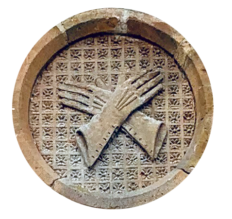
Vaughan Tapscott Gloving Factory
UID List No: 1096065
Grade II
List date: 2003
List Text: Glove factory. 1884; by W.C. Medland; for William Vaughan and Sons, glove makers.
White Marland brick with red brick and stone dressings. Welsh slate roof with coped gable-ends with finials at apex and corbelled brick eaves. Brick axial stack. PLAN: Rectangular on plan. Central entrance at east end with office on right and staircase on left; ground floor with central axial passage and another staircase at rear left. First floor has later partitions; attic storey open to roof. Lean-to outshut on south side might have been the engine house. Victorian Gothic style. EXTERIOR: 2 storeys and attic. East front gable end 2:1:2 bays, centre advanced, ground floor windows have shouldered stone arches in recesses with pointed brick arches with terracotta fish-scale tympana and stone hoodmoulds and cills; central recessed doorway with similar brick arch and colonnettes with carved foliage capitals and polished Devon marble shafts, semi-circular fanlight fanlight and stone hoodmould with corbel stops in form of crossed hands; the hoodmoulds continued over narrow flanking lancets with carved stone medallions above, the right with crossed gloves and the left depicting a glove-press; above the centre breaks forward with a large stone plate-tracery window with a pointed brick arch, louvered openings to left and right and flanking windows with terracotta fish-scale tympana under red brick pointed arches. 10-bay north and south sides have continuous hoodmoulds over alternating pointed and segmental brick arches to ground floor windows and four of the first floor windows recessed with pointed brick arches to the attics in gables breaking the eaves; the south side has lean-to on right. Rear west gable end has pointed brick arches to ground floor windows with terracotta tympana and continuous hoodmoulds, arcade of six lancets on first floor and attic lancet in gable above with oculus on either side linked by hoodmould. Stone stringcourse at first floor window cill level. INTERIOR: Ground floor has axial passage with glazed timber screen on north side and belt drive wheels for machinery. Floors supported on thin cast-iron columns. First floor has later partitions. Attic floor open to queen-post roof structure. Two Victorian Gothic staircases, both with arcaded balustrades and chamfered newels with finials. Boarded ceilings with pierced quatrefoil cornices.
Link to National Record: https://historicengland.org.uk/listing/the-list/list-entry/1096065
Historic Environment Records
Great Torrington Union Workhouse
HER No: MDV55060
Text: Site of the Great Torrington Union Workhouse shown on 19th century map
Ordnance Survey, 1880-1899, First Edition Ordnance 25 inch map (Cartographic). SDV336179.
‘Great Torrington Union Workhouse’ shown on 19th century map as a group of adjoining buildings, with a detached ‘Chapel’ to the south, in a quadrilateral enclosure on the western side of Great Torrington.
Link to National Record: https://www.heritagegateway.org.uk/Gateway/Results_Single.aspx?uid=MDV55060&resourceID=104
Note: Parts of the workhouse complex survived in the modern hospital complex until 1995/1996, when an application for its demolition was received.
Great Torrington Cemetery
HER No: MDV64814
Text: Great Torrington Cemetery is a good example of mid 19th century Burial Board cemetery which retains its 19th century buildings and structural planting.
Link to National Record:
https://www.heritagegateway.org.uk/Gateway/Results_Single.aspx?uid=MDV64814&resourceID=104
The cemetery is also a Registered Park and Garden:
Park and Garden: Grade II
UID List No: 1001580
List date: 2002
List text: Great Torrington Cemetery, which fronts Bideford Road, is a good example of a High Victorian cemetery (it was consecrated in 1856) laid out by a provincial Burial Board. The layout of the cemetery survives intact, together with substantial areas of original planting. It contains contemporary associated structures including two chapels, a lodge and entrance gates and it also contains a good collection of 19th century funerary monuments.
Link to National Record: https://historicengland.org.uk/listing/the-list/list-entry/1001580
Rolle Almshouses, New Street
HER No: MDV441
Text: Rolle Almshouses in Great Torrington, site now occupied by late 20th century sheltered housing.
Link to National Record: https://www.heritagegateway.org.uk/Gateway/Results_Single.aspx?uid=MDV441&resourceID=104
No. 1 Whites Lane
Historic Shop
HER No: MDV23830
List Text: Early or mid 19th century, altered. Two-storey, stucco creamwashed, three windows, sash with exposed frames and now with centre glazing bars only. Bracket eaves cornice. Central wood doorcase with pilasters and plain reveals. Shop front right, with modernisation.
Link to National Record: https://www.heritagegateway.org.uk/Gateway/Results_Single.aspx?uid=MDV23830&resourceID=104
This building is also a Listed Building – Grade II
UID List No: 1332989
Link to National Record: https://historicengland.org.uk/listing/the-list/list-entry/1332989
Great Torrington Canal Company Industrial Complex
HER No: MDV18802
List Text: Site of the offices, limekilns, warehouse, timber and coal stores, and foundry of the Torrington Canal Company later occupied by a dairy complex before redevelopment
Link to National Record: https://www.heritagegateway.org.uk/Gateway/Results_Single.aspx?uid=MDV18802&resourceID=104
Rolle Canal Basin
HER No: MDV14285
List Text: Site of the Rolle Canal double basin on the site of the Manor Mills and later occupied by a creamery before redevelopment
Link to National Record: https://www.heritagegateway.org.uk/Gateway/Results_Single.aspx?uid=MDV14285&resourceID=104
Torrington or Rolle Canal
HER No: MDV445
List Text: Torrington Canal, also known as Rolle Canal was built between 1823 and 1827. It ran from a lock on the River Torridge in Landcross parish and broadly followed the river south to a canal basin adjacent to Taddiport Bridge. It closed in the early 1870s. Part was then used for the route of the North Devon Railway and part for Rolle Road.
Link to National Record: https://www.heritagegateway.org.uk/Gateway/Results_Single.aspx?uid=MDV445&resourceID=104
Stanlea House, stables for Rolle Canal
HER No: MDV20305
List Text: Stanlea House in Great Torrington, said to have been the stables for the Rolle Canal
Link to National Record: https://www.heritagegateway.org.uk/Gateway/Results_Single.aspx?uid=MDV20305&resourceID=104
Rolle Canal Aqueduct
HER No: MDV65503
List Text: Site of 19th century Rolle Canal Aqueduct in Great Torrington
Link to National Record: https://www.heritagegateway.org.uk/Gateway/Results_Single.aspx?uid=MDV65503&resourceID=104
Railway Station, in the Parish of Great Torrington (now Puffing Billy)
HER No: MDV434
List text: Torrington station. Remains of narrow gauge railway built to connect with the clayworks at Peters Marland and Petrockstow
Link to National Record: https://www.heritagegateway.org.uk/Gateway/Results_Single.aspx?uid=MDV434&resourceID=104
Railway, in the Parish of Great Torrington
HER No: MDV18633
List Text: North devon railway. Ss47852000-ss48001977. Exeter-Barnstaple-Bideford line extended to Torrington in 1872. Now closed for passenger use.(bone). Further details on ss53se/16, and sx99sw/148. This stretch extends from ss47852000 to ss48001977.
Link to National Record: https://www.heritagegateway.org.uk/Gateway/Results_Single.aspx?uid=MDV18633&resourceID=104
Rifle range to the North of Great Torrington
HER No: MDV73354
List Text: Site of a rifle range shown on 19th century map to the north of Great Torrington (possibly associated with the local militia).
Link to National Record: https://www.heritagegateway.org.uk/Gateway/Results_Single.aspx?uid=MDV73354&resourceID=104
Drill Hall, 88 New Street
HER No: MDV106741
List Text: Former Drill Hall, maybe local militia connection – later used in WWI.
Link to National Record: https://www.heritagegateway.org.uk/Gateway/Results_Single.aspx?uid=MDV106741&resourceID=104
Former Liberal Rooms, Church Walk
HER No: MDV111012
List Text: Former Liberal Rooms converted to photographer’s studio in 1978.
Link to National Record: https://www.heritagegateway.org.uk/Gateway/Results_Single.aspx?uid=MDV111012&resourceID=104
Beam Aqueduct, Monkleigh, Great Torrington
HER No: MDV18808
List Text: Beam Aqueduct built in 1824 to carry the Torrington Canal over the River Torridge. Situated in the grounds of Beam House.
Link to National Record: https://www.heritagegateway.org.uk/Gateway/Results_Single.aspx?uid=MDV18808&resourceID=104
Great Torrington Mission Hall
HER No: MDV35020
List Text: Mission Room marked on 1906 Ordnance Survey map.
Link to National Record: https://www.heritagegateway.org.uk/Gateway/Results_Single.aspx?uid=MDV35020&resourceID=104
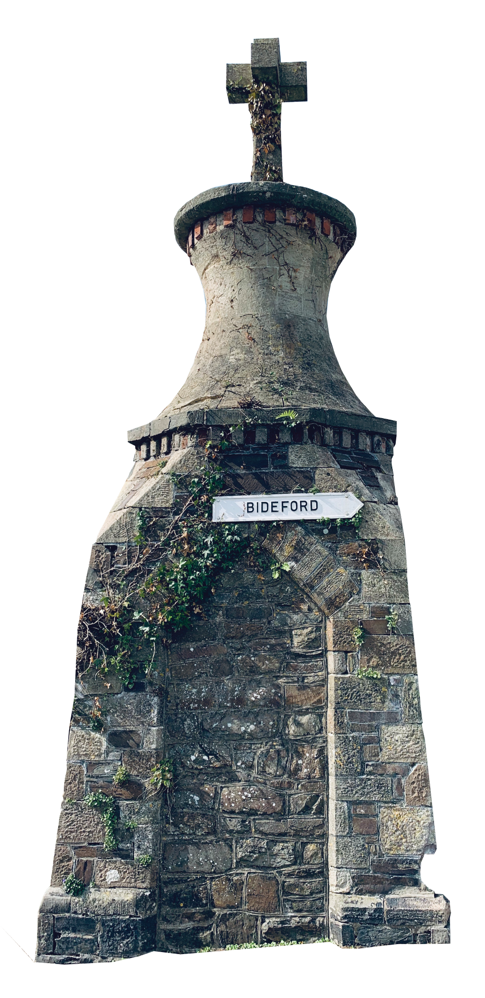
Windy Cross
HER No: MDV442
List Text: Surmounting a 19th century former pump-house at the west end of South Street is a cross, of which the shaft and circular base are said to be ancient, but have been re-cut. These features are an unusual land-mark in the town.
Link to National Record: https://www.heritagegateway.org.uk/Gateway/Results_Single.aspx?uid=MDV442&resourceID=104
Tenter Ground, Rack Park, Great Torrington
HER No: MDV65505
List Text: Field called ‘rack park’ shown on the 1843 tithe map. Probably one of the fields laid out by william callon who undertook in his lease of 1777 to ‘inclose the said demised premises with hedges, walls or rails’. The name is suggestive of racks or tenters on which cloth would have been stretched prior to the erection of the drying linhay
Link to National Record: https://www.heritagegateway.org.uk/Gateway/Results_Single.aspx?uid=MDV65505&resourceID=104
Great Torrington Waterworks
HER No: MDV67702
List Text: ‘Reservoir (Great Torrington Water Works)’ shown on late 19th century mapping.
Link to National Record: https://www.heritagegateway.org.uk/Gateway/Results_Single.aspx?uid=MDV67702&resourceID=104